The vast, featureless expanse of the open ocean presented humanity with one of its greatest navigational challenges. For millennia, venturing beyond the sight of land was a gamble, a journey into the unknown where determining one’s precise location was a matter of estimation, intuition, and often, sheer luck. Yet, the drive to explore, trade, and connect across the seas spurred relentless innovation in the art and science of finding position far from shore. This journey takes us from relying on the subtle clues of the heavens and handcrafted instruments to tapping into a network of orbiting satellites.
Early Voyagers and the Coastal Crutch
In the earliest days of seafaring, navigation was primarily coastal. Mariners hugged the shoreline, relying on familiar landmarks – distinctive hills, river mouths, capes – to guide their way. This method, known as pilotage, was effective for short voyages but inherently limiting. Venturing into the blue required different techniques. Dead reckoning became crucial: estimating position by calculating the vessel’s course (direction steered) and speed over a period of time from the last known point. However, errors accumulated quickly due to unpredictable currents, wind leeway, and inaccuracies in measuring speed (often done by simply tossing a log overboard and timing its passage). Early celestial navigation offered some help; the angle of the North Star (Polaris) above the horizon gave a reasonable estimate of latitude in the Northern Hemisphere, and the sun’s path across the sky provided directional cues. But these methods were rough and highly dependent on clear weather.
The Longitude Puzzle: A Question of Time
While determining latitude (north-south position) became manageable with instruments like the astrolabe and later the quadrant, finding longitude (east-west position) remained a formidable obstacle for centuries. Latitude relies on measuring the altitude of celestial bodies relative to the horizon, an angle that changes predictably with one’s north-south movement. Longitude, however, is intrinsically linked to time. The Earth rotates 360 degrees in 24 hours, meaning each hour corresponds to 15 degrees of longitude. To know your longitude, you needed to know the precise time at your current location and simultaneously know the precise time at a known reference point (like the prime meridian in Greenwich, London). Comparing these two times would reveal the longitudinal difference.
The challenge was keeping accurate time at sea. Pendulum clocks, the standard on land, were useless on a rolling, pitching ship. The quest for a reliable marine chronometer – a clock unaffected by the motion of a vessel and resistant to temperature and humidity changes – became one of the great scientific endeavours of the 18th century. John Harrison’s eventual success in creating accurate sea clocks was revolutionary.
The Age of the Sextant
Alongside the chronometer, the sextant emerged as the quintessential tool for celestial navigation. Developed independently by John Hadley in England and Thomas Godfrey in America around 1731, the sextant allowed mariners to measure the angle between any two visible objects with far greater precision than earlier instruments. Typically, this involved measuring the altitude (angle above the horizon) of the sun at its highest point (local apparent noon) to determine latitude, or measuring the altitude of the sun, moon, planets, or specific stars at known times (using the chronometer set to Greenwich Mean Time) to calculate lines of position.
Using a sextant required considerable skill and knowledge. The navigator needed to handle the instrument steady on a moving deck, accurately read the vernier scale, and perform complex spherical trigonometry calculations (initially by hand, later aided by nautical almanacs and sight reduction tables). Corrections had to be applied for factors like instrument error, index error, dip (the height of the observer’s eye above sea level), refraction (the bending of light through the atmosphere), parallax, and the semi-diameter of the sun or moon. A typical “fix” involved taking sights of two or more celestial bodies to obtain intersecting lines of position, pinpointing the vessel’s location on the chart. For nearly two centuries, the sextant and chronometer were the gold standard for offshore navigation, enabling global exploration and trade on an unprecedented scale.
Important Information on Navigation Redundancy. Despite the incredible accuracy of modern systems, electronic navigation is vulnerable to signal jamming, spoofing, equipment failure, and power loss. Prudent mariners still maintain proficiency in traditional methods, including celestial navigation with a sextant, as a vital backup. Over-reliance on a single system can have serious consequences in remote or contested waters.
Radio Waves and Early Electronics
The 20th century brought new technologies. Radio direction finding (RDF) allowed ships equipped with receivers and directional antennas to determine the bearing to shore-based radio beacons. By taking bearings on two or more beacons, a vessel could plot its position. Later, hyperbolic navigation systems like LORAN (Long Range Navigation) and Decca Navigator used synchronized radio signals from multiple land-based transmitters. A ship’s receiver measured the tiny time differences in the arrival of these signals to determine its position relative to the transmitters. These systems offered greater accuracy and all-weather capability compared to celestial navigation but were limited by their geographic coverage, primarily available in coastal regions and major shipping lanes of the Northern Hemisphere.
The Satellite Revolution: GPS and GNSS
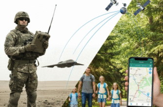
The true paradigm shift arrived with the advent of satellite navigation. Conceived initially for military purposes, the US Global Positioning System (GPS) became fully operational for civilian use in the 1990s, changing navigation forever. GPS relies on a constellation of satellites orbiting the Earth, continuously broadcasting timing signals and their orbital data.
How Satellite Navigation Works
A GPS receiver on a ship listens for signals from multiple satellites simultaneously (at least four are needed for a 3D position and accurate time). By precisely measuring the time it takes for each signal to arrive, the receiver calculates its distance from each satellite. Since the satellites’ positions are known, the receiver can determine its own location on Earth through a process called trilateration. It essentially finds the unique point where the spheres defined by the calculated distances from each satellite intersect.
The impact was immediate and profound:
- Global Coverage: Satellite signals reach virtually every point on Earth’s surface.
- All-Weather Capability: Unlike celestial navigation, satellite systems work day or night, in any weather condition.
- Unprecedented Accuracy: Standard civilian GPS typically offers accuracy within a few meters, vastly superior to previous methods.
- Ease of Use: Receivers automatically calculate and display position, speed, and course, requiring minimal user input compared to the complexities of sextant sights and calculations.
Today, GPS is just one part of a broader category known as Global Navigation Satellite Systems (GNSS). Other constellations include Russia’s GLONASS, Europe’s Galileo, and China’s BeiDou. Modern maritime receivers often utilize signals from multiple constellations simultaneously, further enhancing reliability and accuracy.
The Modern Integrated Bridge
On the bridge of a modern vessel, satellite navigation is the cornerstone of a suite of integrated electronic systems. GPS/GNSS receivers feed precise position data into Electronic Chart Display and Information Systems (ECDIS), which overlay the ship’s position, course, and speed onto detailed electronic nautical charts. This provides navigators with real-time situational awareness. Autopilots use GNSS data to steer precise courses, Automatic Identification Systems (AIS) broadcast and receive vessel identity and position information to prevent collisions, and voyage data recorders log critical navigational parameters. While the fundamental task remains the same – knowing where you are and where you’re going – the tools have become incredibly sophisticated, automated, and precise.
From peering through a sextant at a noon sun to glancing at a digital display showing position to within meters, the evolution of finding position at sea represents a remarkable journey of human ingenuity. It’s a testament to our persistent efforts to conquer the challenges of the vast ocean, transforming perilous voyages into predictable passages through the power of observation, mathematics, and technology orbiting far above.
